Public health organizations worldwide now have a new mobile app available to help them gather information needed to battle disease and assess the needs of populations often facing significant health challenges.
Designed for use in areas with limited connection to cellular networks by workers using phones with limited functionality, the new app – called GPSSample – will make health studies (such as those estimating vaccination coverage, disease burden, or health impact during emergencies) faster and less costly to organize and administer. The app integrates into a single offline map-based program, census-taking, sample-generation, and data-gathering – functions previously requiring separate tools, more time, and more resources to conduct.
GPSSample builds on an earlier app called EpiSample, which was used for field studies in previous years using the Windows Mobile operating system.

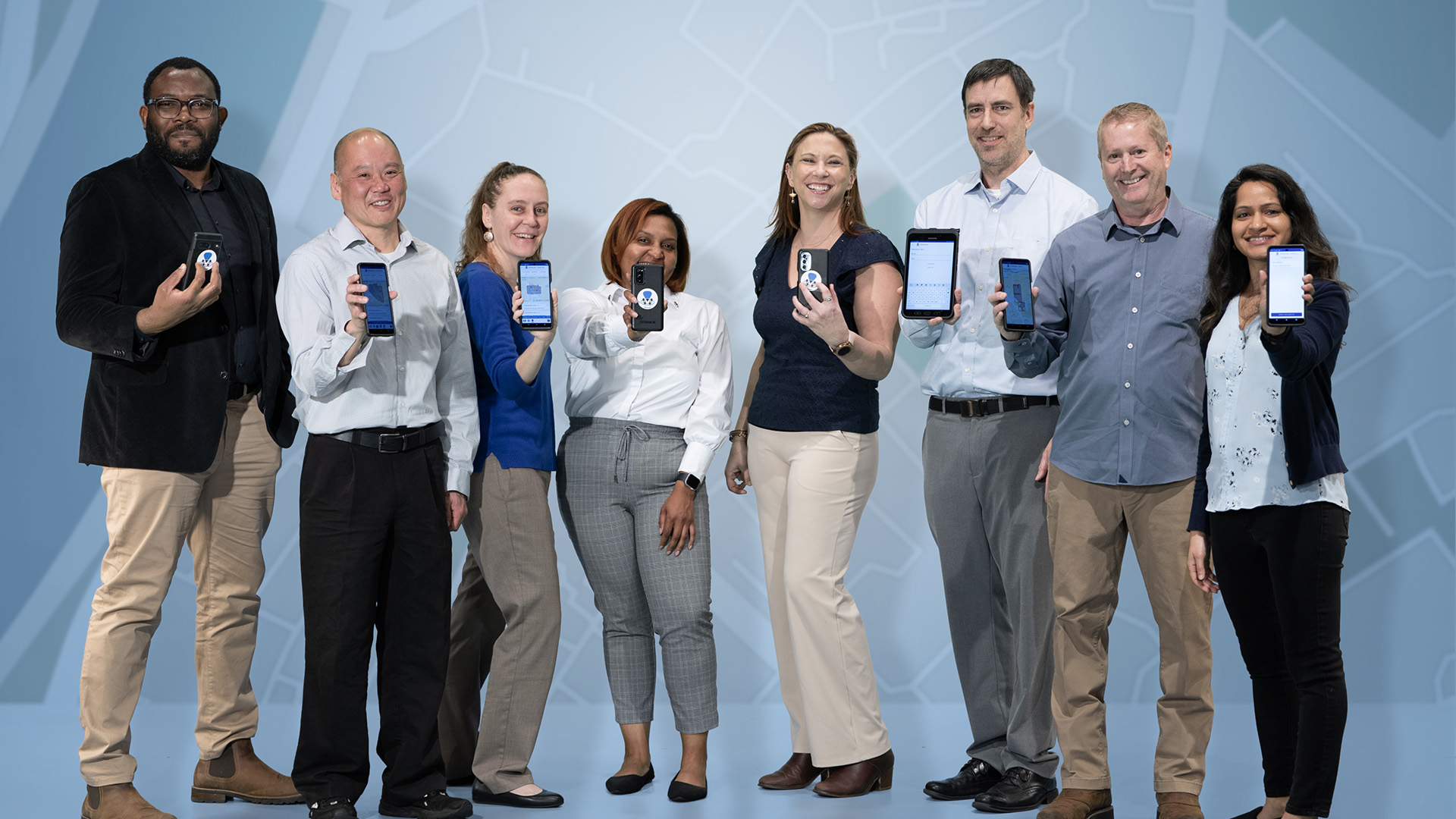
Left: The GPSSample App uses a QR code for file sharing between devices, without the need for a cellular or internet connection. (Credit: Sean McNeil, GTRI) Right: CDC Researcher Dr. Monica Shah shows a map of an enumeration area that would be used during field studies. (Credit: Sean McNeil, GTRI)
Operating offline between devices
An essential requirement for GPSSample was to permit the flexibility to accommodate a range of security and technology standards in low-resource settings around the world. The first major challenge was to support offline map-based programs in the field without a network connection. The second major challenge was transferring files between study team members without network or Wi-Fi connectivity.
GPSSample supports secure file transfers between devices using a QR code to link the devices in the field without network connectivity. Alternatively, users can connect devices to the internet to download and share secure files after returning from the field.
Sampling by a supervisor in the field
For surveys, the app generates the sample population to be interviewed in the field, eliminating the time required for outside resources to draw statistically valid samples.
“The purpose of the app is to support field epidemiologists and others who want a reliable estimate of the proportion of the population protected by vaccination or to study disease prevalence or outbreaks,” said Megan Denham, a senior research associate at the Georgia Tech Research Institute (GTRI), which collaborated with the Centers for Disease Control and Prevention (CDC) and Task Force for Global Health (TFGH) to develop the app. “GPSSample will help to get assistance to the people who need it more quickly and efficiently because it will replace multiple separate tools now being used.”
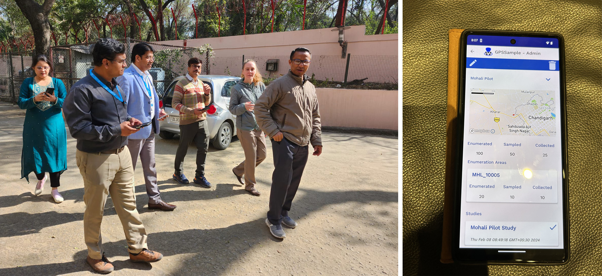
Left: GPSSample India testing team walks through an enumeration area. (Credit: Monica Shah, CDC ) Right: GPSSample administrator screen shows the status and progress of data collection. (Credit: Amber Dismer, CDC )
Interest from Many Organizations
Beyond the CDC, GPSSample will support the work of ministries of health in dozens of countries, as well as other local and global health organizations. It is now available to download from the Google Play Store for Android 8+ devices. In 2022, the GPSSample project was selected as a finalist by the CDC’s Office of Science Data Modernization Initiative as a project with key public health impacts. Funding from the CDC supported GTRI researchers in developing the new app.
“For the public health community, the free GPSSample app is a sampling tool missing from our global toolbox for years,” said Amber Dismer, the project’s principal investigator in the CDC’s Division of Global Health Protection, Global Health Center. “Whether this is being used to support an immunization coverage survey, earthquake responses, studies, or humanitarian responses, we are thrilled this is now a tool for the public health community.”
By combining a multi-step process into a single app and streamlining the workflow, GPSSample can reduce the cost and time needed to conduct studies in parts of the world difficult for public health workers to reach.
“The traditional process could require significantly more time to conduct a study, which in cases involving outbreak studies or disaster relief, is just too long to be able to get assistance out to the people who need it,” said Denham. “Having all the required pieces combined into a single sampling app will avoid many steps, decrease the likelihood of errors, and get these studies done more quickly and at lower cost.”
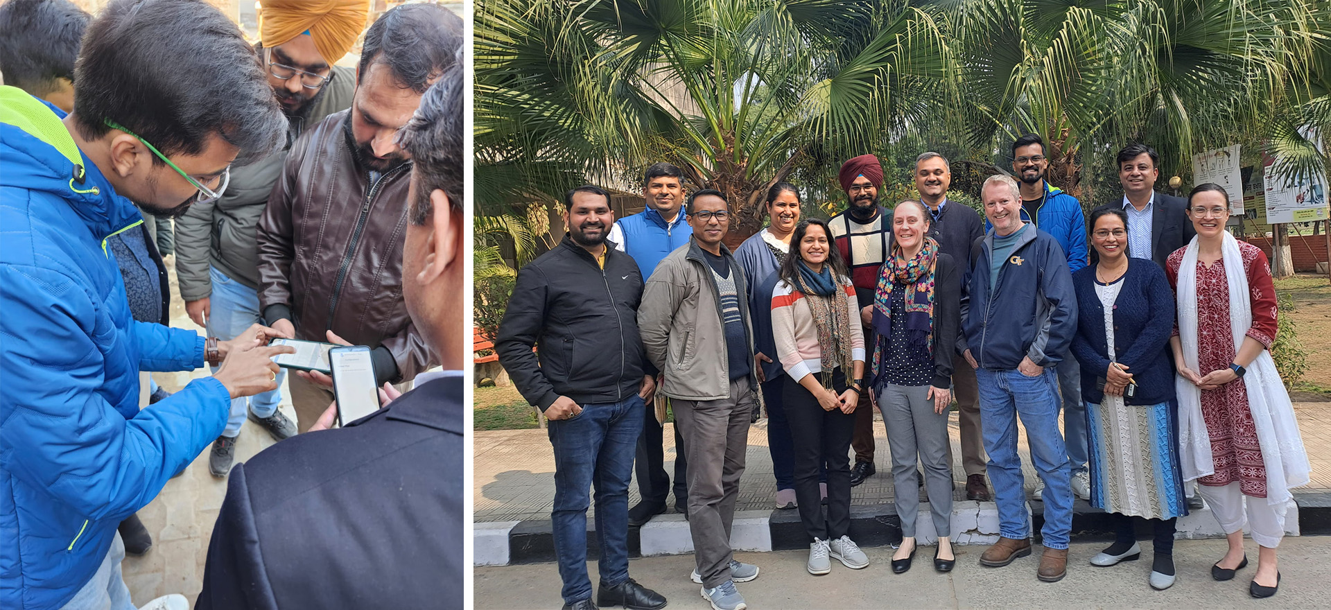
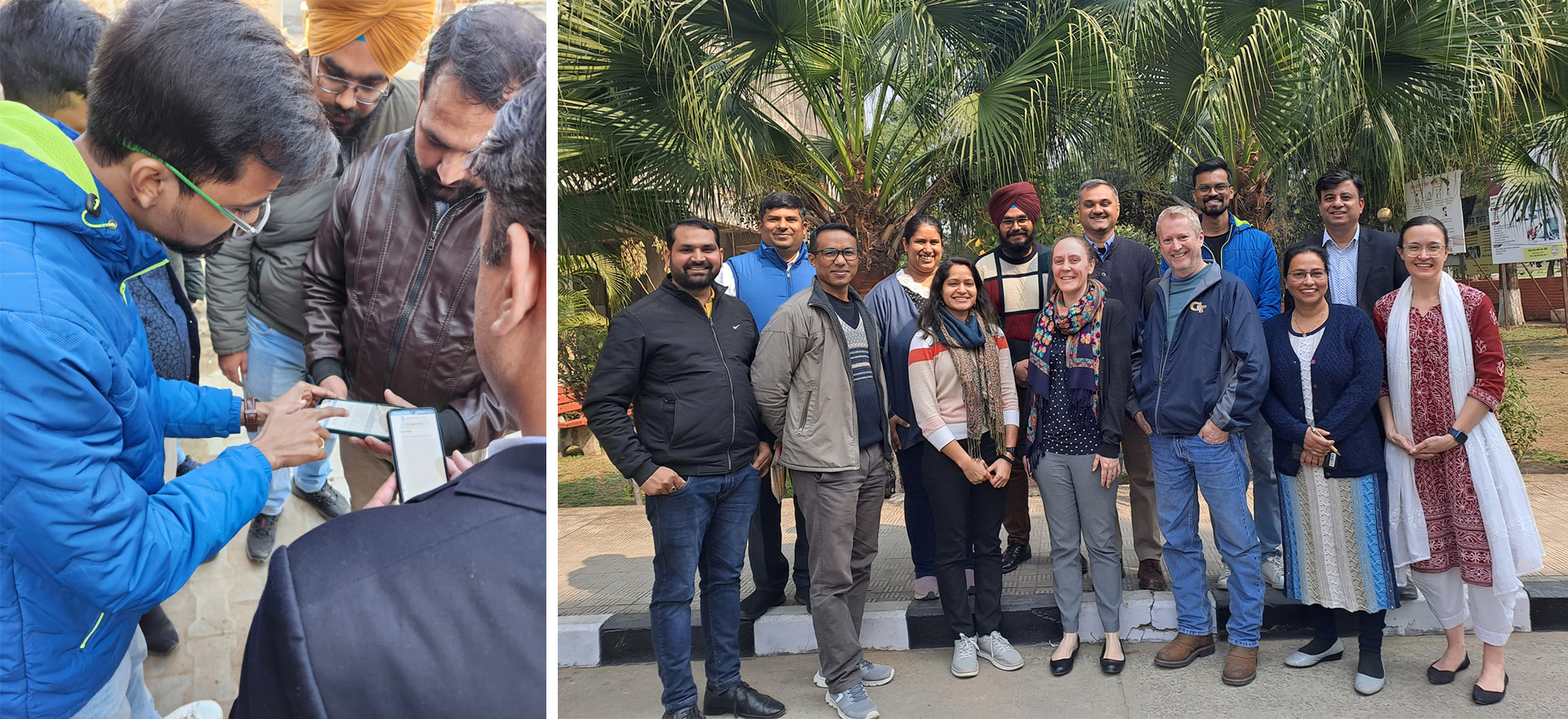
Left: Members of the India team field testing the GPSSample App. (Credit: Monica Shah, CDC ) Right: GPSSample testing team in India with representatives from the Centers for Disease Control and Prevention (CDC), Georgia Tech Research Institute (GTRI), the World Health Organization (WHO), Field Epidemiology Training Program (FETP) and Growing Expertise in E-Health Knowledge and Skills (GEEKS). (Credit: WHO India)
Designed for Workers in the Field
A study of vaccination rates for a disease such as measles or polio, for example, might go something like this:
First, the administrator in charge of the study would establish the locations to be studied, called the enumeration areas, within which the survey will be conducted. A census of the area will first determine the number of people – perhaps broken out by categories such as the number of children – who live in the selected area. Enumerators will be assigned specific locations to collect census data where they will go house to house to determine how many people are living there and verify the homes and other structures where residents live.
To support this enumeration step, maps would be downloaded to each enumerator’s phone, showing the area they are to visit. The use of these maps in the field does not require an active cellular connection. The supervisor uses GPSSample to generate a local network connection and QR Code. The enumerator then scans the QR Code with their phone’s camera to receive and send data.
Next, each enumerator would gather information on the number of people at each location and enter the data into the app. Teams can also update the downloaded maps when they see changes, record the location of temporary residences such as schools and community centers which may be housing displaced persons, and record other helpful information. They can also add key locations such as health posts, community meeting locations, markets, water sources, schools, and places of worship that may be important for navigation and context.
App Avoids Making Two Visits
Once enumeration is complete and data are transferred to the supervisor’s device, the supervisor can draw a statistically valid sample based on the study configuration. The supervisor would then transfer the household information and surveys to the assigned data collection teams using the same QR code file-sharing approach.
The app’s ability to create the sample and support conducting the survey allows the study to be done in a single visit, reducing the time and cost involved, Dismer explained. Once the study team has navigated to selected households, they can automatically toggle between GPSSample and a popular survey tool called Open Data Kit (ODK) to conduct the survey itself.
“Teams can deploy with an enumerator and a supervisor, use a fast, gold-standard sampling method, and do the entire survey in one trip,” Dismer said.
When the workers return from the field, the information they gathered will be downloaded to the supervisor’s device and then transferred to an administrator for analysis.
“In global immunization work, GPSSample is an important tool for conducting statistically valid immunization coverage surveys in low-and-middle-income countries,” said Dr. Louie Rosencrans, an epidemiologist in the CDC’s Global Immunization Division, Global Health Center. “This can help immunization program managers understand where door-to-door immunization campaigns have performed well and where households were missed, requiring follow-up visits by vaccination teams.”
Dr. Louie Rosencrans, Dr. Monica Shah, Amber Dismer and Joel Adegoke (l-r), members of the GPSSample team from the Centers for Disease Control and Prevention (CDC). (Credit: Sean McNeil, GTRI)
A Flexible Tool
GPSSample was initially set up to connect with ODK, but the choice can be changed to suit the needs of specific organizations conducting surveys.
“The system is designed for maximum flexibility,” Denham said. “The configuration process allows the administrators to determine the information to be collected, the enumeration area, rules for sampling methodology, and other factors.”
In November 2023, GTRI and CDC personnel held a GPSSample workshop for Kenya's African Field Epidemiology Network annual conference. The app was tested in India in early February 2024 by the World Health Organization team, Field Epidemiology Training Program (FETP), and Growing Expertise in E-Health Knowledge and Skills (GEEKS) fellows. The developers plan to collect feedback on the app and add functionality where needed. Already, more than 60 organizations – including ministries of health from around the world – have indicated interest in using GPSSample.
Bottom Line: Making surveys more efficient in low resource settings
Denham and her colleagues recognize how important the app could be in addressing global health challenges. GPSSample can be used to support efforts to reduce acute malnutrition, childhood mortality, neglected tropical diseases, malaria, HIV, violence against children, and other public health efforts, including chronic diseases.
“This is an incredibly important project that we are all honored to work on,” she said. “We hope it will be used to improve access to critical health services for the world’s highly vulnerable and marginalized populations, to move the needle in the fight to make healthcare a fundamental human right.”
In addition to those already listed, the CDC team also includes Ben Nygren, Joel Adegoke, and Monica Shah from the Global Immunization Division, Global Health Center, and Amy Lang in the Geospatial Research, Analysis, and Services Program, Agency for Toxic Substances and Disease Registry. Other GTRI researchers included Brian Parise, Russell Mitchell, Dianna King, and Keyonia Holland.
Writer: John Toon (john.toon@gtri.gatech.edu)
GTRI Communications
Georgia Tech Research Institute
Atlanta, Georgia USA
The Georgia Tech Research Institute (GTRI) is the nonprofit, applied research division of the Georgia Institute of Technology (Georgia Tech). Founded in 1934 as the Engineering Experiment Station, GTRI has grown to more than 2,900 employees, supporting eight laboratories in over 20 locations around the country and performing more than $940 million of problem-solving research annually for government and industry. GTRI's renowned researchers combine science, engineering, economics, policy, and technical expertise to solve complex problems for the U.S. federal government, state, and industry.

